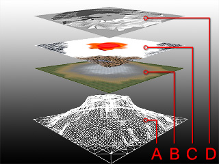
A: Model Mesh Entity - Generated by Heightmap.
B: Definition of Detailmap - Generated by Detailmap.
C: Painted Color Texture - Generated by Colormap.
D: Light and Shadow Map - Generated by Lightmap.
EarthSculptor's open-architecture program with no proprietary format gives you the benefit to modify texture files and reload them to fulfill any advanced editing using your familiar painting software.
The structure for one terrain project can be described in the following table:
|
|
A: Model Mesh Entity - Generated by Heightmap. |
|
B: Definition of Detailmap - Generated by Detailmap. |
|
|
C: Painted Color Texture - Generated by Colormap. |
|
|
D: Light and Shadow Map - Generated by Lightmap. |
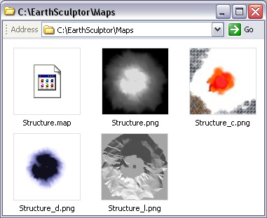
There are certain naming rules for one terrain project, which facilitate the program and the user to figure out the accurate image files for specific project.
Heightmap - It is saved as <file name>.png.
Detailmap - It is saved as <file name>_d.png. This file contains the mask status for detailmap channels. And the texture image applied is actually an external file. Therefore, if you move this PNG to elsewhere, make sure the texture image files are also moved along to the same location.
Colormap - It is saved as <file name>_c.png.
Lightmap - It is saved as <file name>_l.png.
Project - It is saved as <file name>.map. This file is a text file describing the relations of the terrain project and the image files.
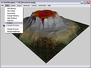
In order to add details to those maps, you can quickly access them through a feature provided as described below:
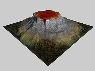
Please create a new terrain and modify it, including sculpting, painting, or lighting.
Save the terrain project to a target folder.
Access Utility / Explore in the menu bar.
System explorer locates the project file and its related map files.
|
Note: |
|
Please refer to Utility > Reload: Updating Terrain for more information about how to modify a terrain project with external image editor and how to update. |