Utilizing Height Map

As you use the Terraform tool to modify the folds of the terrain, you actually modify a PNG (16 bits or 24 bits) file in grayscale. In the PNG file, the white color represents the higher ground while the black color represents the lower one. The gray colors then depict the slopes and details of the terrain.

You may then modify the PNG file via any supporting external image editor and reload the modified file back to EarthSculptor to create different terrain with even more exquisite folds.

  1. Launch image editor. Create a new square image file.

  2. Create a grayscale image. Save it in PNG format, none interlaced.

    Sharp-edged grayscale Image

    Gradient grayscale image.

  3. In EarthSculptor, access to Import/Heightmap image. Browse to the image created in step 2 and click OK to load it.

  4. The Terrain is generated according to the grayscale data of the file.

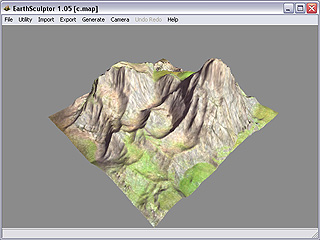
    Result from sharp-edged grayscale image

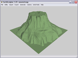
    Result from gradient grayscale image.

Note:

  • Please refer to Utility > Explore: Tracking Project Maps for more information.